A. LA ESTRUCTURA DE LA TIERRA
A.1. LA DERIVA DE LOS CONTINENTES
A.2. LOS AGENTES QUE MODIFICAN EL RELIEVE
1. Internos: volcanes y terremotos 2. Externos; agua, viento, vegetación y el ser humano
B. LAS FORMAS DEL RELIEVE
B.1. RELIEVE CONTINENTAL Y DE COSTA
B.2. RELIEVE OCEÁNICO
B.3. LAS FORMAS DEL RELIEVE EN EL MUNDO Y ESPAÑA
- REVIEW! *The Earth's surface. *European physical space. *Landforms on a map(español)- Spanish landforms
PARA SABER MÁS!!
PARA SABER MÁS!!
APUNTES
A.3. LOS AGENTES QUE MODELAN EL RELIEVE
1. INTERNOS: LIBRO P.16 y 17 se producen cuando el _____ del manto presiona la corteza terrestre.
- TERREMOTOS: es un movimiento rápido y _______ (sacudida) que sale del interior de la Tierra y se extiende como ______________ con efectos destructivos. Partes: Hipocentro (en el interior, donde se origina el terremoto) y el ____________ (punto de la superficie terrestre más próximo al hipocentro)
- VOLCANES: es una apertura de la ______________que conecta con el manto. El magma sube por esta grieta, por la _________ del volcán, pudiendo erupcionar por el _______ y formando montañas o _______.
- VOLCANES: es una apertura de la ______________que conecta con el manto. El magma sube por esta grieta, por la _________ del volcán, pudiendo erupcionar por el _______ y formando montañas o _______.
2. EXTERNOS: LIBRO P.18 y 19
- LA TEMPERATURA
Si son extremas pueden romper la
roca. Por ejemplo: el agua al congelarse aumenta de volumen y si se encuentra
en una grieta rocosa, la rompe.
- LA ACCIÓN DEL AGUA
Si está en un río, en su nacimiento
arranca material y abre valles, en el curso medio transporta esos materiales y
en la desembocadura los deposita, acumulándose el material.
Si está en el mar, con las mareas y
las olas va formando acantilados rocosos o playas arenosas.
- LA ACCIÓN DEL VIENTO
El viento puede transportar
materiales (arena) que, al chocar contra las rocas, las erosionan.
- LA ACCIÓN DE LOS SERES VIVOS
La vegetación, animales y seres humanos cambiamos el
relieve. Por ejemplo: las raíces de un árbol o al construir un túnel en una
montaña.


1. Watch this video!
APUNTES
B. LAS FORMAS DEL RELIEVE LIBRO P.14 y 15
En tu
cuaderno, escribe la definición de cada forma del relieve.
B.1. RELIEVE CONTINENTAL Y DE COSTA
*RELIEVE CONTINENTAL
1. Montaña:
2. Cordillera:
3. Valle:
4. Llanura:
5. Meseta:
6. Depresión:
*RELIEVE DE COSTA
1. Playa:
2. Acantilado:
3. Península:
4. Istmo:
5. Isla:
6. Archipiélago:
7. Cabo:
8. Golfo:
B.2. RELIEVE OCEÁNICO
1. Plataforma continental:
2. Talud continental:
3. Llanura abisal:
4. Dorsal oceánica:
5. Fosa marina:
|
|
B.3. LAS FORMAS DE RELIEVE MÁS IMPORTANTES DEL MUNDO EN EL LIBRO p. 24 y 25
B.4. EL RELIEVE ESPAÑOL
1. LA MESETA
- Ocupa parte del centro de la Península Ibérica. Se diferencia la Submeseta Norte y Sur, ya que está dividida por el Sistema Central.
- Está rodeada por los Montes de León (NO), la Cordillera Cantábrica (N), el Sistema Ibérico (E), Sierra Morena (S) y hacia el O desciende y es donde desembocan los ríos (ej._______)
2. RELIEVE FUERA DE LA MESETA
- El Macizo Galaico que está muy erosionado.
- Los Pirineos, son cordilleras de gran altura (Pico de Aneto)
- La Cordilleras Costero Catalanas.
- Las Cordilleras Béticas, son dobles: la Subbética y la Penibética (Sierra Nevada)
- Depresiones muy fértiles, como la del Guadalquivir y la del Ebro.
3 LAS ISLAS
- El archipiélago Canario, de origen volcánico (Teide), todas sus islas.
- El archipiélago Baleárico (Sierra Tramontana), todas sus islas.
2. Label each picture with a yellow word. Then write a definition for each word.


AHORA... REPASO DEL RELIEVE DE LA PENÍNSULA IBÉRICA: MAPA INTERACTIVO!!!
island canyon peninsula isthmus volcano mountain plateau valley hill


EJERCICIOS 68 Y 69 DE LA P. 31
3. Draw the following imaginary landscape in your notebook:
In the northwest we find a mountain chain called The Halcones, formed by young mountains. Between them, the most famous valley appears, because in it is the town of Villa Franc, that is crossed by a river called Franc. The mountains are descending towards the south-east up to turning into a plain sowed with cultures of trees. In the North-east do not forget to draw the Golden Plateau. In the south we observe a rectilinear coast. The river Franc ends to the south-east in the shape of delta. In the line of coast of the southwest we find the cape of The Death and the gulf of Saints.
AHORA... REPASO DEL RELIEVE DE LA PENÍNSULA IBÉRICA: MAPA INTERACTIVO!!!
4. PLAY GAMES!
4.1. Locate the tallest world mountains by continents.
4.2. How mountains, rivers and canyons are formed? Click on this link:
4.1. Locate the tallest world mountains by continents.
4.2. How mountains, rivers and canyons are formed? Click on this link:
WORKBOOK UNIT 2 LINK FOR THE ACTIVITY "WORKING WITH THE WEB"
CONTINENTAL LANDFORMS
LANDFORMS are natural formations of rock and soil on Earth's surface. Landforms vary depending on the height and shape of the land.
Some landforms are created by EROSION, a natural process by which land surfaces are worn away by the action of water, wind and ice.
Other landforms are formed by INTERNAL PROCESS, earthquakes and volcanoes.
WHAT ARE THE MAIN CONTINENTAL LANDFORMS?
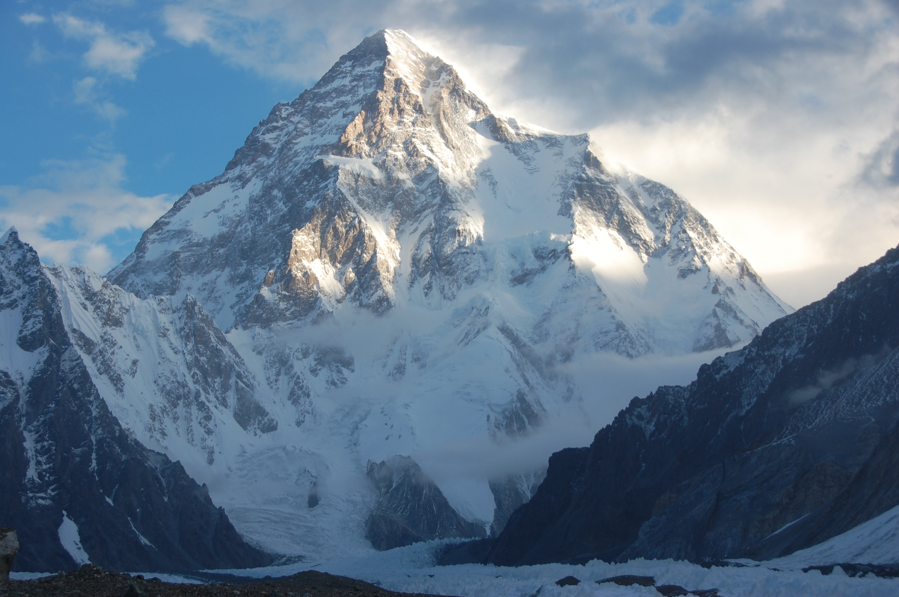
MOUNTAINS: High landforms or rocky peaks. Ex. Mount Everest.
MOUNTAIN RANGE: A chain of connected mountains. Ex. The Himalayan mountain range ad the Andes.
HILL: a mountain but lower in elevation.
VALLEY: a low area between mountains. A river valley is V-shaped, ex. the Grand Canyon. A glacial valley is U-shaped.
PLATEAU: A large and flat highland. ex. Tibet.
PLAIN: A large area of land with a low and flat relief. Ex. Great Plains of the Central United States.
DEPRESSION: A landform where the land is lower than the surrounding area. The Guadalquivir depression.
COASTAL LANDFORMS
A coast is a piece os land next to a sea or ocean.
What creates coastal landforms?
- PLATE MOVEMENTS:
ISLAND: A piece of land surrounded by water. Ex. Greenland and Iceland.
ARCHIPELAGO: A group of islands. Ex. Japan and Great Britain.
GULF: An area of an ocean or sea partially surrounded by land. Ex. Gulf of Mexico and of Guinea.
PENINSULA: An area of land, almost surrounded by water. Ex. Florida, the Iberian peninsula.
ISTHMUS: A narrow strip of land connecting two larger land areas. Ex. Isthmus of Corinth.
CAPE: A pointed piece of land that sticks out into a sea. Ex. Cape of Good Hope.
- WAVE EROSION:
CLIFF: A high and steep slope of rock and soil.
CAVE: A sea cave is formed when waves hit a cliff.
ARCH: A hole in a cliff formed by powerful waves.
- THE DEPOSIT OF ERODED MATERIAL:
BEACH: An area where there is an accumulation of sand, pebbles, shells...and which is exposed to action of waves along the coast.
- BY RIVERS:
DELTA: is formed at the mouth of a river when it deposits sediment. Ex. the Nile Delta.
LINK FOR LANDFORMS/WATER FORMS PROJECT!!
Click here to see the definitions for the PROJECT / EXTENDED VERSION
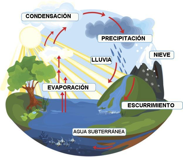
1. See an animated diagram of the "Water Cycle"! Then read this text and draw this picture on your notebook.
 The water cycle. It is the continuous circling of water between the sea, atmosphere and land.
1. Evaporation. Water in the sea and lakes is heated by the sun's rays. It evaporates as water vapour and rises into the atmosphere.
1. Transpiration. Water vapour from the leaves of trees and plants rises into the atmosphere.
2. Condensation. Air cools and water vapour condenses to form clouds of small water droplets.
3. Saturation
4. Precipitation (Rainfall) Clouds get full of water and rain star to fall.
5. Infiltration. Some of the rain goes into the ground, it is called aquifers.
A.2. DULCE: Lagos y ríos LIBRO P.42
- LAKES are small bodies of freshwater surrounded by land. Ex. the Great Lakes in America.


2. MAKE SURE YOU KNOW WHAT IS THE WATER CYCLE.
3. Check what you know about Rivers. Try to do the quiz clicking on the kids! FLASHCARDS REVIEW
T.3. LA HIDROSFERA
A. LOS TIPOS DE AGUA
A.1. SALADA: Oceános y mares A.2. DULCE: Lagos y ríos
B. LOS MOVIMIENTOS DEL AGUA DEL MAR/OCEÁNO
B.1. Las Olas B.2. Las Mareas B.3. Las Corrientes Marinas
C. LAS AGUAS DEL PLANETA
C.1. Por continentes C.2. Península Ibérica
LINK FOR LANDFORMS/WATER FORMS PROJECT!!
Click here to see the definitions for the PROJECT / EXTENDED VERSION
1. See an animated diagram of the "Water Cycle"! Then read this text and draw this picture on your notebook.
1. Evaporation. Water in the sea and lakes is heated by the sun's rays. It evaporates as water vapour and rises into the atmosphere.
1. Transpiration. Water vapour from the leaves of trees and plants rises into the atmosphere.
2. Condensation. Air cools and water vapour condenses to form clouds of small water droplets.
3. Saturation
4. Precipitation (Rainfall) Clouds get full of water and rain star to fall.
5. Infiltration. Some of the rain goes into the ground, it is called aquifers.
A. LOS TIPOS DE AGUA LIBRO P.39
A.1. SALADA: Oceános y mares


- OCEANS are large bodies of salt water and there are five: __________.
- SEAS are smaller bodies of salt water than oceans and they are near of a continent. Ex. the Mediterranean sea.


- LAKES are small bodies of freshwater surrounded by land. Ex. the Great Lakes in America.
- RIVERS are freshwater bodies that flow towards the sea, ocean, lake or another river. Parts os a river:
1. SOURCE: where the river begins, in mountains.
2. MOUTH: where the river flows into the sea or ocean.
3. CHANNEL: where the river flows.
4. TRIBUTARIES: smaller streams that join the main river.
Rivers flow in linear forms called VALLEYS, they change as they reach the sea. Courses of a river:
- THE UPPER COURSE: the river is steep, so water flows with energy and removes rocks and soil: EROSION.
LANDFORMS: canyons or V-shaped valleys. Waterfalls.
- THE MIDDLE COURSE: the river is lower and slower, it carries the erored materials: TRANSPORTATION.
LANDFORMS: valleys and meanders (curves of the river)
- THE LOWER COURSE: the river flows very slowly, it deposits the material: DEPOSITION.
LANDFORMS: deltas.
B. LOS MOVIMIENTOS DEL AGUA DEL MAR/OCEÁNO LIBRO P. 38
Las aguas marinas están en constante movimiento, estos movimientos son tres:
B.1. Las Olas
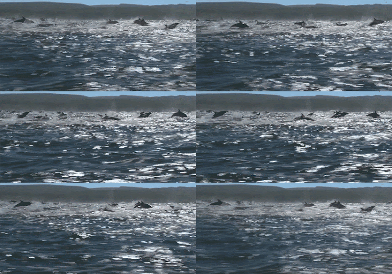
- Son ondulaciones de la superficie del mar producidas por el viento. Su movimiento es circular y rompen al rozarse con el fondo del mar.
- Son ondulaciones de la superficie del mar producidas por el viento. Su movimiento es circular y rompen al rozarse con el fondo del mar.
B.2. Las mareas
- Son subidas y bajadas diarias del nivel del mar debido a la atracción del Sol y la Luna. Cuando sube se le llama marea alta o pleamar y cuando baja, marea baja o bajamar.
B.3. Las Corrientes marinas
- Son desplazamientos de grandes masas de agua que circular por los océanos, similares a los ríos. Hay dos tipos: cálidas y frías, e influyen en el clima de las costas.
C. LAS AGUAS DEL PLANETA EN EL LIBRO P. 44-45
C.1. Por continentes
C.2. Península Ibérica
- Do you know it? Are you sure? Let me see...click on this.
2. ¿QUÉ SABES DE LAS FORMAS DEL RELIEVE Y AGUA?
Pincha aquí para abrir el ejercicio.
Pincha aquí para abrir el ejercicio.


No hay comentarios:
Publicar un comentario